Sunday, 9 June 2019

The Macclesfield and Peak Forest Canals

Leaving the Llangollen canal we arrived at the Shroppie, turning left and the short hop up to Barbridge. The village moorings were very busy but we managed to squeeze into a spot vacated by a leaving boater. These moorings require a large gap between the boat and bank due to a shelf under the water.
Monday 13th May
Another fine dry day saw us setting off for the short hop to Barbridge junction, we had passed this on our way to and back from Chester, this time however, we made the right turn onto the Middlewich branch, taking us down to the Trent and Mersey canal, the branch is a short but delightful canal with 4 deep locks spread out along its length, a few years ago we traveled along here stopping at the delightful village of Church Minsul, today however we carried on crossing the large embankments with fine views across the Weaver valley. We arrived at the third lock, dropping down to the pound that suffered the major breach in March 2018. We crossed the site close to the aqueduct that carries the canal over the river Wheelock, the banks and embankment have all been repaired and apart from the new concrete edges there was little evidence of the devastation that had occurred.
The repaired breach site


Image result for middlewich breach pictures
An aerial view of the breach 
We arrived at the final lock of the branch and dropped onto the T&M, turning right to head south towards Stoke on Trent. We climbed the first five locks of "Heartbreak Hill" before tying up at the village of Wheelock for the night. This is a nice little place, now mainly a suburb of Sandbach. It was here that we received the depressing news that the Leeds Liverpool canal would not re-open until the 18th June, this meant that we would have to cross the Pennines via the Rochdale canal, something we had vowed not to do again as it is prone to closures and suffers from a lack of water over the summit pounds. All this was also subject to the lock at Marple re-opening on time scheduled for the 24th May.
Crossing the M6
Tuesday morning brought more fine weather, we had arranged to meet Dave and Anne Brice that evening at the Rising Sun in the village of Scholars Green so an early start was require as we had some 10 miles and 27 locks to negotiate. Our climb started immediately and carried on until we reached the service station up at Red Bull close to Kidsgrove. I covered our last trip up the hill in our blog www.kellyscapers.blogspot.com/2017/09/trent-and-mersey-canal.html.
The double locks of "Heartbreak Hill"

Leaving the services we climbed the last three locks reaching the summit of the T&M, between the last two locks we passed under the start of the Macclesfield (Macc) canal crossing overhead on an aqueduct.
Passing under the branch to the Macclesfield
Once through the top lock we arrived at Hardingswood junction, here we turned right to start our first time trip along the Macc.
Hardingswood Junction

Shortly after the junction the canal turns sharply to the right now running parallel to the T&M, another sharp right hand turn took us onto the aqueduct and over the canal we had just traveled up.
A mile or so further on brought us to the stop lock and the true start of the Macc, the stop lock was built as the two canals were run by separate companies and the T&M wanted to control access to their water, as they were concerned that the new canal would take trade away from them.
Evidence of the rivalry was indicated by the two different lock keepers cottages built alongside.
The stop lock at the true start of the Macc
Note the two contrasting cottages of the two companies

A short distance further on brought us to the moorings at Scholars Green just as Dave and Anne were arriving. We walked the short distance to the Rising Sun and had a great evening catching up with their news. Dave and Anne are currently exploring Europe in a motor home and it was interesting listening to their adventures and how they were also coping with life in a small space.
Scholars Green Moorings
We decided to stay put for another day so we could walk up to Mow Cop, an impressive landmark that had provided a backdrop to our recent travels we could see the imposing peak from the top of the locks at Hurleston. The walk from the moorings was a couple of miles climb and steep from the start, so we took our time as the weather was warm and sunny.
The views started to unfold as we made our ascent, soon arriving in the pretty village that lies just below the summit. The summit is capped by what looks like a castle but is actually a 17th century folly. The views from here were as good as any I have seen in this country, The 360 degree view looks over Derbyshire, Staffordshire, Shropshire, Cheshire, Lancashire and North Wales. We could see a large portion of the area we had covered over the last couple of months with Beeston Castle and  the Welsh Hills prominent. Other features that we picked out were the large radio telescope, at Jodrell Bank and Manchester Airport.
Mow Cop Summit


Thursday morning arrived and we decided to make our way further along this delightful canal mooring above the town of Congleton. We visited the town that had almost become our home as I had briefly worked there, during a short career move, back in the eighties. The town is a quite a pleasant place and lies about a mile downhill from the canal. We managed to find another oatcake shop so loaded up with some of their goodies to take back to the boat. We had moored close to an impressive Aqueduct, another on designed by Telford, he surveyed the route of the canal but the engineering was undertaken by William Crosley, however, being a Telford canal this required large aqueducts, cuttings and embankments, remarkably there is only one flight of locks along its 26 miles.
Congleton Aqueduct
Leaving Congleton we crossed over the enormous embankment and aqueduct that spans the Dane valley. The canal meanders quite a bit here avoiding the impressive hill known as the Cloud.
The Cloud
This brought us to the bottom of the flight of the 12 Bosley Locks, we made good progress through even though we had to drain the first half dozen. The locks are easily operated, well built and in good order and it wasn't long before we met the three lock keepers near the top.
The bottom of Bosley Locks
The view from the top
Once on the higher level we made our way to good moorings just outside of Macclesfield, these are adjacent to the business and retail park just off the Leek road.
Sunday morning we decided to move a little further along, here the canal leaves the outskirts of the town through lovely countryside with views across Cheshire dropping away to our left and the hills of the dark peak to our right, this point is closest to the Peak District National Park.
The canal soon returns to the edge of Macclesfield and we moored up adjacent to the Puss in Boots pub, after mooring up we realised that there are now good pontoon moorings just beyond the bridge, however we stayed put and went off to explore the town. Again, as was the case at Congleton, the canal keeps its distance from the town on a ledge above the river Bollin. We walked the mile or so down to the town which straddles both sides of the valley so we had to climb the steep hill to reach the centre. We liked Macclesfield, although small it retains a lot of its original shops sitting alongside the usual chains, its impressive town hall is testament to the wealth the town must have enjoyed in its heyday as a center for the production of silk. It also has a lot of pubs ranging from the modern such as Weatherspoons to some old traditional establishments.
Macclesfield Silk Road
We decided to return to the Puss in Boots close to the canal and went to sample their very reasonably priced carvery, this exceeded all expectations and the landlady even provided a pick from carvery for Scruff , for a small fee, this was gone in seconds!
Back to the boat we moved on again reaching the boat yard at Bollington Wharf we received a very friendly welcome here and filled up with water and tipped out the Elsan for a small £2 fee.
Bollington Aqueduct
We pushed across the canal to moor beside the enormous Adelphi Mill now converted to offices and apartments.
We took a stroll into the village, a charming spot with its gritstone cottages, nestled in the valley, here the canal crosses on a very high aqueduct, another very impressive structure.
Monday morning brought bright and warm weather and we set off heading for our next port of call at Higher Poynton, passing the impressive Clarence Mill en-route.
Clarence Mill
 This area boasted 74 coal mines in the past but little evidence remains of them today. The canal has a number of wharfs and basins around here, these served the various collieries and tramways. We moored by the wide section of the canal overlooking the playing fields, a lovely spot with
a wide aspect to the southwest, its a very popular spot and the spaces were soon filled.
It was approaching time to change the engine oil as we were nearing the 250 hour point since leaving Mercia in March, I took advantage of the fact that there was a recycling point nearby and was able to dispose of the old oil and filters.
The wide at Higher Poynton

Tuesday morning and we decided to head for the Peak Forest canal at Marple junction, passing through more sublime countryside before arriving at the pretty junction with its charming wharf.
Approaching Marple Junction

At the junction we passed under the stone bridge, turning right to head towards Whaley Bridge, to the left is the first of the 16 locks that make up the Marple flight.  As we leave the junction the view to our left sees the land falling rapidly away to the river Goyt in the valley whist the hills climb away to the right, this pretty much sets the scene for this canal as it makes its perilous way along the side of the valley.
Views across the Goyt Valley
The Goyt eventually becomes the Mersey at Stockport
The views are stunning looking across the valley towards the South Pennine hills. Progress is slow as the water is quite shallow in places and is interrupted by several lift and swing bridges all adding to the charm of this old waterway.
We passed an interesting boat on our way.
What a" Plonker"

As we approached the town of New Mills, straddled across the valley, we arrived at the Swizzler factory, home of Parma Violets, sherbet dabs, love hearts and other such famous sweets, the factory is in an old mill, having relocated here from London during the blitz. The building sits right along side the canal and the smell emanating from here brought back many childhood memories, also tempting us to go and see if they had a factory shop. Alas all sales are now done online.
We carried on passing the long marina at Furnace Vale before arriving at a junction, the left turn leading to Bugsworth, we carried straight on passing the useful Tesco store before winding at the historic wharf in Whaley Bridge. Retracing our steps we moored up in the heavily wooded section between the town and the junction.
We walked back to explore the town, particularly the area around the basin, which was the western terminus of the High Peak railway. We had explored the other end of the line on the Cromford  canal, previously, the railway linked the two canals making its way over the Peak District by meas of inclined planes, a good website explaining this remarkable feat of engineering can be seen at http://www.pittdixon.go-plus.net/c+hpr/c+hpr.htm
There is an old trans-shipment warehouse where goods were moved from train to boat and vice versa under cover. Evidence of the old rails can be seen as well as the old incline making  its ascent up to the hills.
Whaley Bridge basin
Just around the corner from here is the very old Goyt Inn, well worth a visit.
The next morning we cruised around the corner to Bugsworth basin to be amazed at what we saw here.
The restored basins are a mecca for the industrial archaeologist, once the busiest inland port in the country, the basin was built for the trans-shipment of limestone and lime from the surrounding area, opening in 1795 to serve the six mile Peak Forest Tramway connecting the quarries.
 It is a beautiful place with many restored wharfs and basins, a testament to the society that came together to restore this incredible place, back in the sixties. There are also the remains of lime kilns where limestone was processed into lime, a product used for mortar, whitewash and for improving acidic soils. The process involved the stacking of layers of coal then limestone, creating a furnace after firing the lime was removed from the bottom of the stack. Whilst today the area is a green oasis for wildlife, in its day it was a filthy industrial site with smoke and caustic fumes belching from the kilns.
Visit www.bugsworthbasin.org/  for further information and details about the organisation now caring for the site.
A view across the basins


A sample of the old tram rail
old sleeper stones


We spent the night here before moving back down the canal to moor at the top of the locks at Marple, giving us a day to explore before the long awaited re-opening of the flight.
We liked Marple, a much larger place than we anticipated with many local shops and a large and useful Asda. We walked down the steep hill below the town to reach Marple Bridge, another charming little place nestled in the valley alongside the river Goyt.
Marple Bridge
Here we enjoyed a good lunch with my brother John and his wife Tracy who were attending a country music festival nearby.
Climbing back up the hill we came to the point where the lock flight passes under the road, following the flight back up to the top. We noticed that a CRT workboat had passed through on a trial run testing the repaired locks prior to its re-opening.
Saturday morning arrived and we went to meet the lock keeper, he was busy briefing his volunteers before unlocking lock 16 at the top of the flight.
These locks are some of the most picturesque on the system, the top four dropping down along side the houses of the village. Details of the locks can be seen here http://www.marplelocks.org.uk/marple_locks_guide.pdf
The locks were opened in 1796 and are a civil engineering marvel dropping 210 feet to the aqueduct that crosses the valley 100 feet above the river.
It was at the aqueduct, nearly two years ago, that we received the news that the locks had closed due to the collapse of lock 15.

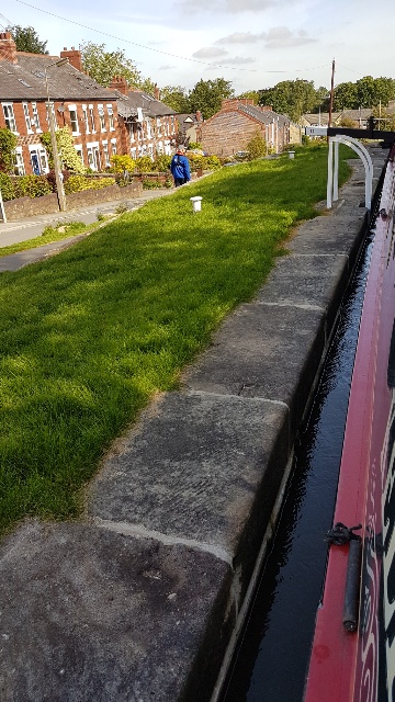
The rebuilt lock 15
Lock 15, last time we were here there was
a gaping hole where the grass is to the side of  the lock
The rebuilt lock 11
Old warehouse above lock nine
The trip down was a real pleasure and we were assisted by 2 lock keepers making good progress we arrived at the bottom in under two hours.
We continued along the Lower Peak Forest canal, crossing the Goyt valley over the impressive aqueduct. We traveled this stretch almost two years previously, details of this journey were written in an earlier blog.
We reached the end of the canal at Portland junction to moor up for the evening before our descent into Manchester.

The end of the Peak Forest at Portland Basin


Sunday, 2 June 2019

The Wash Crossing

Tuesday 2nd July
It was with great excitement that we awoke to a gloriously sunny day and not a breath of wind. It was clear that the Wash crossing would go ahead as planned.
I had spent half the night lying awake thinking about the things that could go wrong and what I would do in such circumstances, but the excitement and adrenaline suppressed any tiredness.
We rose early and had our breakfast then readied ourselves for positioning outside the lock adjacent to the Grand Sluice that separates the Lincolnshire lowlands from the sea. The lock is unusual in that it operates in both directions.
 At low tide the lock holds back the river Witham and flow from the river is controlled by the giant sluice gates, this way the level of the river is maintained except in severe flood conditions. High tides bring a water level higher than that of the river so the sluice then prevents the tide from extending upstream.
Due to this arrangement passage through the lock can only be achieved when the water levels are equal, usually an hour or so either side of high tide. Passage has to be booked although on this occasion the pilot had already done this for us.
Awaiting departure at the Grand Sluice
There were four boats passing through, ourselves, Seren Rose, the two guys on the Broads cruiser who were going to France and a small boat heading to the Black Sluice, a short distance downstream.
We were all in place for 8.30 am ready for a 9.30 departure. Daryl, the pilot, arrived and gave us a briefing, stating that he would communicate with us via the radio, and advise along the way. My main concern was that we would be following the larger boat and that we may struggle to keep up but Daryl reassured me that there is no point in rushing as all timings were controlled by the tides.
With every one in place we were informed by the lock keeper that high water had passed and that the level was dropping. He commenced opening the upstream gates before finally opening the downstream pair and signalling that we could proceed via a green light. Seren Rose went first followed by us then the two other boats, we sailed straight through the lock and were quickly into the ebbing tide heading down the haven through the town.
The Haven, Boston

We made good progress as the tidal flow soon picked up taking us past the fishing boats that had recently moored up on the incoming tide.
Fishing boats moored in Boston
The channel widened as we approached the Wash, however we remained in the channel for sometime staying close to the north shore line.
Leaving the channel from Boston
The channel gradually began to relinquish its grip on the shore as we started to head more of a south easterly course heading out to the middle of the Wash, now following the buoys marking the channel.
Looking back towards Boston
We were now starting to feel at sea with the land around us fading into the distance. We started to feel the gentle swell of the sea and noticed a boat heading out at great speed, we learned later that this was a fisheries protection vessel.
The wash from this boat reached us shortly afterwards with several waves over three foot high, I quickly maneuvered the boat to  face these head on to minimise the rolling effect and thankfully got through to calmer waters.
A screenshot showing our route, the dark
line is the plotted route and the red arrow is our position.
Our course was now set southerly, crossing the deep waters of the middle Wash, here we waved goodbye to the adventurous chaps on the broads cruiser as they took a more easterly path out into the North Sea.
We could make out the village of Hunstanton on the south shoreline and sand banks to our right with seals sunning themselves in the lovely weather.
To my surprise the pilot took a more easterly turn heading across the channel that would take us into Kings Lynn, we found out later that this was to minimise the effect of the swell on Seren Rose. We eventually made a right turn into the channel then headed over to the sandbanks.
We ran the boat up onto the sand alongside Seren Rose, there was no need to use the anchor as the ebbing tide left us sat firmly on the sandbank.
Running up onto the sand

I got our ladders out and climbed down onto the sand carrying Scruff down with me. She enjoyed her time here running around exploring and digging with a whole new range of smells for her to experience, I did have to keep a close eye on her as there were a few Jelly fish around. We returned to the boat and ate a late lunch as it was around five hours since our departure.
Waiting for the tide
Photo by Cherryl Holliday
Strolling on the sands
Photo by Cherryl Holliday
After a couple of hours or so the tide turned and we could feel the boat starting to move, I started the engine and held the boat against the sand until Seren Rose also started to lift. I backed away to give the bigger boat room to maneuver off the sand, once a float again we headed off to see the large number of seals gathered on the north side of the channel, they were popping up all around us curious at the strange craft invading their territory.
The lovely Seren Rose
Distant seals

We spent almost hour with the seals before turning round and heading back into the channel to join the swift tidal flow taking us in towards the Great Ouse estuary and Kings Lynn.
The channel narrowed and we were joined by a couple of fishing boats that kindly past us with a minimum wash.
Kings Lynn
We were now in the mouth of the river and the pace quickened as the estuary narrowed, we shot past the wharfs of Kings Lynn before heading into the last 16 miles of the trip up to Denver Sluice, this part of the trip was the most challenging as we were now struggling to keep up with Seren Rose, Daryl, using his experience, was finding the fastest flow and we tried to follow, eventually we caught up. Daryl radioed us pointing out the few difficult stretches, the first being passage under a large bridge built on a bend, we were told that it is important to take the correct line here as the flow can push the boat into the bridge piers and it can be difficult to get off them, fortunately we got through ok. The next hazard was a sharp bend with a very shallow inside edge, we followed the pilot round and again following a bit of rolling in the flow, got through unscathed. This left the final approach to the lock at Denver, we were hoping this would be set ready to accept the large boat but it was still closed on our arrival.
The approach here is tricky, as there is a large sand bank on the approach, it is necessary to circumnavigate this before pulling up onto the lock landing. Seren Rose hit the landing head on before turning broadside onto the pontoon, unfortunately this left me little room to get round and the tide started to pull us round towards the mouth of the New Bedford river, this could have been a real problem as it would have been difficult to turn and stem the tide. Again fortunately I managed to recover the control and with great relief  crept up to the pontoon.
Entering Denver Lock

Seren Rose locked through first, followed by us. Luckily there was space on the moorings so we tied up and jumped onto dry land for the  first time in 11 hours.
That was it, another bucket list item fulfilled, and I have to say it was a great experience, we finished the day off with a celebratory drink, in the Jenyns Arms with Cherryl and Ian before retiring early to recover from the excitement of the day.
Safely moored on the river

We intend to explore the Great Ouse and some of its tributaries before returning back to Denver and a short tidal trip across to Salters Lode and the river Nene.
Useful contacts Wash pilot - Daryl - 07909 880071  - washguide@gmail.com
Ian on Seren Rose videoed the crossing we appear as a small dot in several places you can watch the video using the following link https://youtu.be/PO6N3zTkXkE
I took a short video in the deepest part of the crossing https://youtu.be/OCQ5_SXEIYo


Looking back out to the Wash

Friday, 24 May 2019

Llangollen Canal

Monday 29th April
Start of the Llangollen - Looking back down the flight at Hurleston

Our start on this much lauded canal began with a lovely spring morning, the countryside resplendent in its green, new growth.
We planned a short trip up to the first sizable village of Wrenbury, not very big and only a few miles from Nantwich and Crewe, around the canal, by a hydraulic lift bridge sits the canal basin and the first of the many boat hire points along this popular canal. There are two pubs here and a camping and caravan site along side the towpath.
Wrenbury basin

The short trip consisted of  5 miles and 6 locks we had to join a short queue at some of the locks but generally made good progress. The scenery was very pastural, typical of South Cheshire.
We called into the Cotton Arms, a nice spot, dog friendly and  good beer.
The following morning we set off heading for Whitchurch a further 10 miles and 10 locks, the first four locks are spread out over a couple of miles before the impressive climb up the Grindley Brook flight,  this flight consists of 3 single locks followed by a three chamber staircase. This flight is notorious for long queues, particularly on a Thursday due to the timing of the hire boat changeover days, fortunately for us it was Wednesday and  we only met one boat coming down. We were soon at the top passing the pretty tea rooms overlooking the staircase. The staircase is manned and it is important to inform the lock keeper of you presence before starting your passage thorough. 
Grindley Brook locks

There are good facilities and about half a dozen water points above the locks.
It is only a short trip along to Whitchurch from here,  there are moorings just before the lift bridge at the junction of the short arm into the town.
This arm used to lead to a basin just below the town center, one of the main cargos leaving the town was the famous Shropshire Blue cheese made here. Sadly the branch closed in 1939 and some of it has been built over. The short length of the arm now in use was restored by the Whitchurch Waterway Trust (www.witchurchwaterway.uk) and they, along with the town council have ambitious plans to restore the route into the town,  including an incline plane to bypass the built over sections,  the aim of the project is to increase tourism into the center.
We reversed into the arm along which there are good moorings.
We took a stroll into the town, a typical market town fortunately still retaining a good range of local shops. It is quite a walk from the canal but certainly worth a visit.
Our next port of call was Ellesmere, we decided on an early start setting off in light rain that gradually eased as the day progressed. This is an interesting stretch of canal and is part of the long 20 plus mile pound between locks, the canal twists is way around low hills for the first few miles before crossing the remote and extensive Whixall mosses, an area used for peat extraction but now restored as a nature reserve. The canal crosses the area by means of long straight sections that have proved problematic over the years due to the unstable ground. Evidence of this can be seen by the extensive pilings on either side.
We passed the short Prees arm leading down to Whixall marina and it was here that we came across an episode of boat rage, we had just, slowly, passed a moored, fibreglass  boat, as a narrowboat came out of the branch turning up towards us. He was moving quite fast in our direction giving me little time to get over to the side,  even though I managed to leave plenty of room he wanted the centre of the canal and gave me a mouthful, I suggested he got a grip, and moved on giving him a large grin which only seemed to exasperate him further.
Between here and Ellesmere the scenery just got better and better, again twisting through the countryside with cuttings and embankments around every corner.
The approach to the town leads through Norh Shropshire's own Lake District, the canal passing close to the shore of several meres. This area is also heavily wooded, adding to its charm. 
Blake Mere near Ellesmere

There is a short arm leading into Ellesmere, with 72 hour mooring along its length,  we sailed to the end of the arm and turned round to moor just beyond the large  and useful Tesco store.
Ellesmere is a charming little place with all facilities to hand. We visited the famous Vermeudens delicatessen,  a must when in the town, the cheese,  pies etc are some of the best we have come across on our travels. 
Ellesmere Basin
Where it all began..
Ellesmere

The large CRT base at Ellesmere

The following morning we moved on heading for Chirk and the Welsh Hills that had provided a backdrop to our journey over the last few days. A few miles along we arrived at Frankton junction where the Montgomery canals drops away to the south we carried along saving our visit to the "Monty"  for another day.  The approach to Chirk is marked by a narrowing of the channel with substantial concrete banks enabling the canal to cling to the steep sides of the valley containing the river Ceiriog, marking the border between England and Wales. The A5 crosses the valley here on an impressive, modern viaduct, the road now bypassing the town. 
The A5 viaduct on the outside of Chirk

Mooring at Chirk bank we walked the mile or so into the town.Telford's A5 passed through here leading to the building of coaching inns and some other fine looking properties in the centre. The town now consists of a large woodchip board and  Cadbury factory, otherwise it is very quiet.
We walked down to the canal at the southern portal of Chirk tunnel before crossing back into England over the valley on Jessup's fine stone aqueduct.
Chirk Aqueduct

Chirk Tunnel
This stretch marks the beginning of the most famous part of this canal, with two aqueducts and two tunnels within the latest ten miles to the terminus.
We began our journey to the terminus on a cold, windy but bright sunny Saturday morning, we quickly came to the Chirk aqueduct crossing the valley before plunging into the tunnel.  Passage through was difficult due to the flow of water coming in the opposite direction, something we had noticed through some of the bridges and narrower sections further back. We finally emerged into a deep cutting, passing the busy marina and hire base. 
Chirk Cutting
Leaving the cutting behind we found ourselves again clinging to the side of a valley, reuniting us with the river Dee, it was here that we got our first glimpse of one of the seven wonders of the waterways.  We arrived at the village of Froncysyllte very popular and busy spot, we had to queue here to pass under the lift bridge.
First glimpse of the iconic aqueduct
Leaving the village the canal takes a sharp right turn heading straight towards the steep valley side and the famous Pontcysyllte aqueduct.
The approach to the narrow iron channel is through a heavilly wooded section before suddenly to our left there was nothing other than the side of the trough between us and the few hundred feet drop to the valley below. It really was an exhilarating experience, to the one side is the drop, to the other a towpath, very busy with visitors from all over the world marveling at what is an amazing feat of civil engineering. As we reached the midway point the wind picked up banging the boat against the side of the trough. 


Pontcysyllte Aqueduct


The design of the structure is usually attributed to Telford,  however it was a joint effort with Jessup, Telford solved the problem of the weight of such a tall stone structure by using the iron trunk method,  resulting in the slender tall pillars striding across the valley.
Reaching the other side, we arrived at the very busy basin at Trevor, our route took us round a very sharp left turn made all the more difficult by the number of spectators and a strong wind, taking it very slowly we completed the manoeuvre and continued our trip to the terminus at Llangollen.
The sharp turn at Trevor

There are warnings about this section been difficult and shallow before becoming very narrow on the approach to the town. The shallow sections are down to a concrete shelf close to the towpath side, once aware of this it was a case of keeping to the centre of the channel with care required when passing boats coming in the opposite direction, we got through these areas unscathed before arriving at the narrow sections. These are clearly marked,  Lucia walked ahead with the walkie talkie keeping watch for anything coming in the other direction. Luckily for us and the two boats following,  our way through was clear right through.
Emerging from the narrows we arrived at the town wharf, a very busy place with horse drawn boats taking people to the end of the channel as well as trip boats headed for the aqueduct.
Just beyond the Wharf is the limit of navigation and a large basin, overlooked by the Eisteddfod pavilion,  providing 48 hour moorings. These are good moorings and are charged at £6 per night, this includes water and electricity. We secured the boat before heading off to explore.
The town was incredibly busy with its steam railway, boat and bus trips. It came as a bit of a shock as we hadn't been anywhere as busy since leaving Chester. 
Llangollen Basin


The gauging house and the canal feed
It is a lovely town despite the crowds (it was the weekend), there are lots of shops, the type  you would expect in a place such as this and it seems to be an ideal centre for exploring the wider area.
We were joined by John Lockwood on the Sunday he kindly brought our mail across with him. John and I walked to the end of the channel, up to Horseshoe falls,  so named due to Telford's  huge  horse shoe  shaped weir that directs water into the channel to feed the canal from the river,  only to return some of it back in Chester.
This feed explains the flow in the canal we had encountered on our way up from Hurleston, the river not only feeds the canal but also feeds water to the reservoir by the junction which in turn provides water for the people of Crewe and Nantwich. 
Horseshoe Falls - Telfords large feeder weir
Care is required at many of the locks as this flow feeds through the by-washes making entry and exit a bit tricky.
A typical by-wash with high flow

There is a valve house at the feed, now controlled automatically, responding to the demands of the system.
We enjoyed a fine evening in the Gales Hotel where we had a great meal,  it is a peaceful haven in a hectic place with great food, it is more of a wine bar, they only stocked bottled beers, not a problem for us.
Monday morning and it was time to retrace our steps back to Chirk, John had left his car at the RAFA club in Llangollen,  they are happy to let you do this for a small donation. We had already determined that there were buses between the two towns so John left use here, returning to collect his car before heading home.
Tuesday morning arrived and we headed back to Frankton junction,  having booked out passage on to the Montgomery canal, booking is required as they only allow twelve boats at a time, onto the restored section. 
The locks at Frankton - the start of the "Monty"

The weather had deteriorated over night and we awoke to heavy rain,  thankfully this subsided a little as we made our way to the 4 lock flight to drop down onto the Monty. This section is six miles but originally went all the way down to Newtown, via Welshpool,  some 33 miles into Wales.  A lot of this canal has been restored but there are a few difficult miles to link the first six miles to the rest of the canal. Much work has been done and still continues so one day the whole length should be navigable again.
The A5 crossing the "Monty"

The weather was miserable for most of our trip down to the village of Maesbury but dried up a little once we arrived, care has to be taken along this canal as there are rare plant species so speed limits are in place through several sections.
Following dinner we went into the Navigation Inn and had a great night chatting to the very friendly locals. 
The Navigation at Maesbury

The village is only a couple of miles from Oswestry and there is a bus service, unfortunately we had to leave the next morning so didn't have time to explore the area.
We made our way back to the junction in more rain but once we arrived at the locks the weather started to improve and we then continued onto Ellesmere where I had arranged to meet a customer to pick up a bit of work.
We stayed in the town for a couple of days before making our way back to the Shropshire Union and the next stage of our adventure.
We enjoyed our couple of weeks on this canal,  it lives up to its reputation,  and any boaters wondering about a trip to the terminus,  don't be put off by the rumours, yes it's busy with lots of hire boaters from all over the world but is great meeting these people,  yes it's shallow in a few places but no more than other canals, the countryside along its length and the excitement of the last section make it worth the effort.

Back at the top of Hurleston locks ready to drop onto the Shropshire Union
The grey hills in the distance are the Derbyshire Dales, we shall be on this ridge when we
reach the Macclesfield Canal

The feed into Hurleston reservoir

The  gentle rolling hills near Ellesmere

Moving On

After a few indifferent days weather-wise things started to improve although there was still a risk NE wind. We decided to walk down to Rest...